
WooCommerce Delivery Area Pro allows visitors and store customers to verify product delivery location before actually placing the order. The delivery area can be defined by Zip Code, by drawing on google maps, by country, by continent, by sub-continent & by specifying store location address with radius kilometer range for delivery.
Please follow these steps to setup product availability collection for shipping ‘by drawing on google maps’.
Step 1: Please navigate to the “WP Delivery Area Plugin -> Add Collection” page, enter your product collection name then select products from “Select Collection Products” that will be associated with this collection. You can create a single collection for your shop or multiple depending on your requirements.
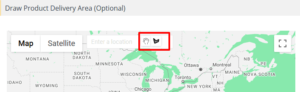
Step 2: Please navigate to the “Draw Product Delivery Area (Optional)”, in this section google map is displaying, here two buttons “Stop Drawing” and “Draw a shape” are given on the map.
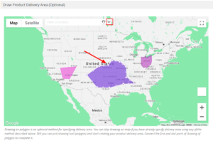
Step 3: For Draw a delivery area on map, please click on given tool “Draw a shape” and start creating your product delivery area on the map, please connect the first and last point of drawing of the polygon to complete it, after creating the shape you can customize it as per your requirement.
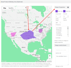
Step 4: Please click on a shape to customize shape property, when you click on the shape you can see some settings “Shape Properties” and “Shape onclick Event” are displaying in this section. Now make changes according to your requirements.
Step 5: Click Save Collection. Now frontend visitors can see delivery area on map.